Bild 1 von 3


Galerie
Bild 1 von 3

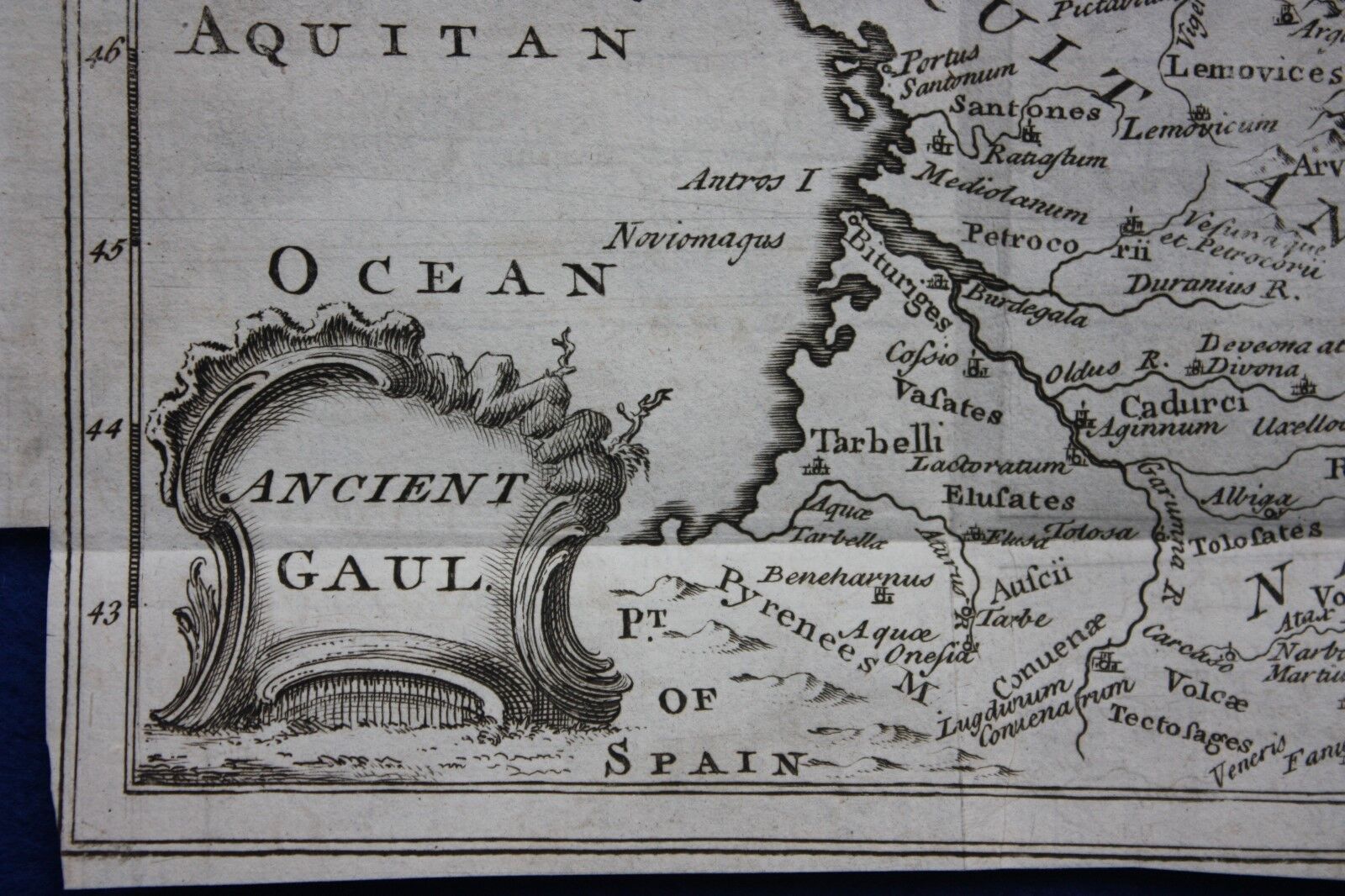

Original antike Landkarte ANTIKES GALLIEN, FRANKREICH, Cellarius, 1747-

£32,00
(inkl. MwSt.)
Ca.EUR 36,61
oder Preisvorschlag
Artikelzustand:
“Very good condition; light age toning. There are several fold creases and it is trimmed close to the ”... Mehr erfahrenÜber den Artikelzustand
- Sofort-KaufenOriginal antike Landkarte ANTIKES GALLIEN, FRANKREICH, Cellarius, 1747
Oops! Looks like we're having trouble connecting to our server.
Refresh your browser window to try again.
Rücknahme:
30 Tage Rückgabe. Käufer zahlt Rückversand. Wenn Sie ein eBay-Versandetikett verwenden, werden die Kosten dafür von Ihrer Rückerstattung abgezogen.
Zahlungen:
Sicher einkaufen
- Gratis Rückversand im Inland
- Punkte für jeden Kauf und Verkauf
- Exklusive Plus-Deals
Info zum Artikel
Der Verkäufer ist für dieses Angebot verantwortlich.
eBay-Artikelnr.:335956310433
Artikelmerkmale
- Hinweise des Verkäufers
- Map Type
- Countries/Borders
- Format
- Sheet Map
- Country/Region
- France
- Size
- 27.5cm x 20.7cm
- Colouring
- Black & White
- Original/Repro
- Original
- Age
- 1700-1749
- Source publication
- An Universal History
- Printing Technique
- Copper Plate
- Era
- 1700s
- Year
- 1747
- Original/Reproduction
- Antique Original
- Cartographer/Publisher
- Cellarius
Artikelbeschreibung des Verkäufers
Rechtliche Informationen des Verkäufers
Info zu diesem Verkäufer

Maps etc. Antique Maps & Prints
100% positive Bewertungen•5.682 Artikel verkauft
Angemeldet als gewerblicher Verkäufer
Verkäuferbewertungen (2.595)
- u***z (698)- Bewertung vom Käufer.Letzte 6 MonateBestätigter KaufShipping - super fast. Packaging - professionally packed. Item - as described and in superb condition. Value - worth buying it. Trusted seller and business done smoothly.
- e***a (77)- Bewertung vom Käufer.Letztes JahrBestätigter KaufI am giving this purchase a 5-star rating, even though the map arrived more than a month late & the shipping tube had been severely mangled (no damage to the contents). Neither problem was the Seller's fault. The shipment was held by US Customs for a month (visible on the tracking documents) without explanation or contact. Seller remained in regular contact, offered to, and then refunded full purchase price during this hiatus. Upon successful delivery, Seller re-invoiced for the map, & I paid.Original antique atlas map BRITISH ISLES, GREAT BRITAIN, IRELAND, E Bowen, 1747 (Nr. 335916077525)
- 1***1 (708)- Bewertung vom Käufer.Letzte 6 MonateBestätigter KaufReceived very quickly and well packaged. Item as described, excellent seller.N. IRELAND, NEWRY, CASTLEWELLAN, DUNDRUM antique road map, Taylor & Skinner 1778 (Nr. 336019391147)
Noch mehr entdecken:
- Antike Original Antike Automobilia,
- Antike Tische, Antik Original 1850-1899,
- Antike Original Anrichten & Buffets 1920-1949, Antik,
- Antike Original 1920-1949, Antik Stühle,
- Antike Original 1920-1949 Sofas & Sessel, Antik,
- Antike Original 1920-1949 Schränke & Wandschränke, Antik,
- Original, Antik Puppenkleidung & Accessoires,
- Original, Antik Puppenhaus-Möbel,
- Antike Original-Tischuhren (bis Kaminuhren,
- Original aus Glas Antike Porzellan-, Vasen, Antik
Maps etc. Antique Maps & Prints
100% positive Bewertungen•5.682 Artikel verkauft
Angemeldet als gewerblicher Verkäufer
Verkäuferbewertungen (2.595)
- u***z (698)- Bewertung vom Käufer.Letzte 6 MonateBestätigter KaufShipping - super fast. Packaging - professionally packed. Item - as described and in superb condition. Value - worth buying it. Trusted seller and business done smoothly.
- e***a (77)- Bewertung vom Käufer.Letztes JahrBestätigter KaufI am giving this purchase a 5-star rating, even though the map arrived more than a month late & the shipping tube had been severely mangled (no damage to the contents). Neither problem was the Seller's fault. The shipment was held by US Customs for a month (visible on the tracking documents) without explanation or contact. Seller remained in regular contact, offered to, and then refunded full purchase price during this hiatus. Upon successful delivery, Seller re-invoiced for the map, & I paid.Original antique atlas map BRITISH ISLES, GREAT BRITAIN, IRELAND, E Bowen, 1747 (Nr. 335916077525)
- 1***1 (708)- Bewertung vom Käufer.Letzte 6 MonateBestätigter KaufReceived very quickly and well packaged. Item as described, excellent seller.N. IRELAND, NEWRY, CASTLEWELLAN, DUNDRUM antique road map, Taylor & Skinner 1778 (Nr. 336019391147)