Bild 1 von 2


Galerie
Bild 1 von 2
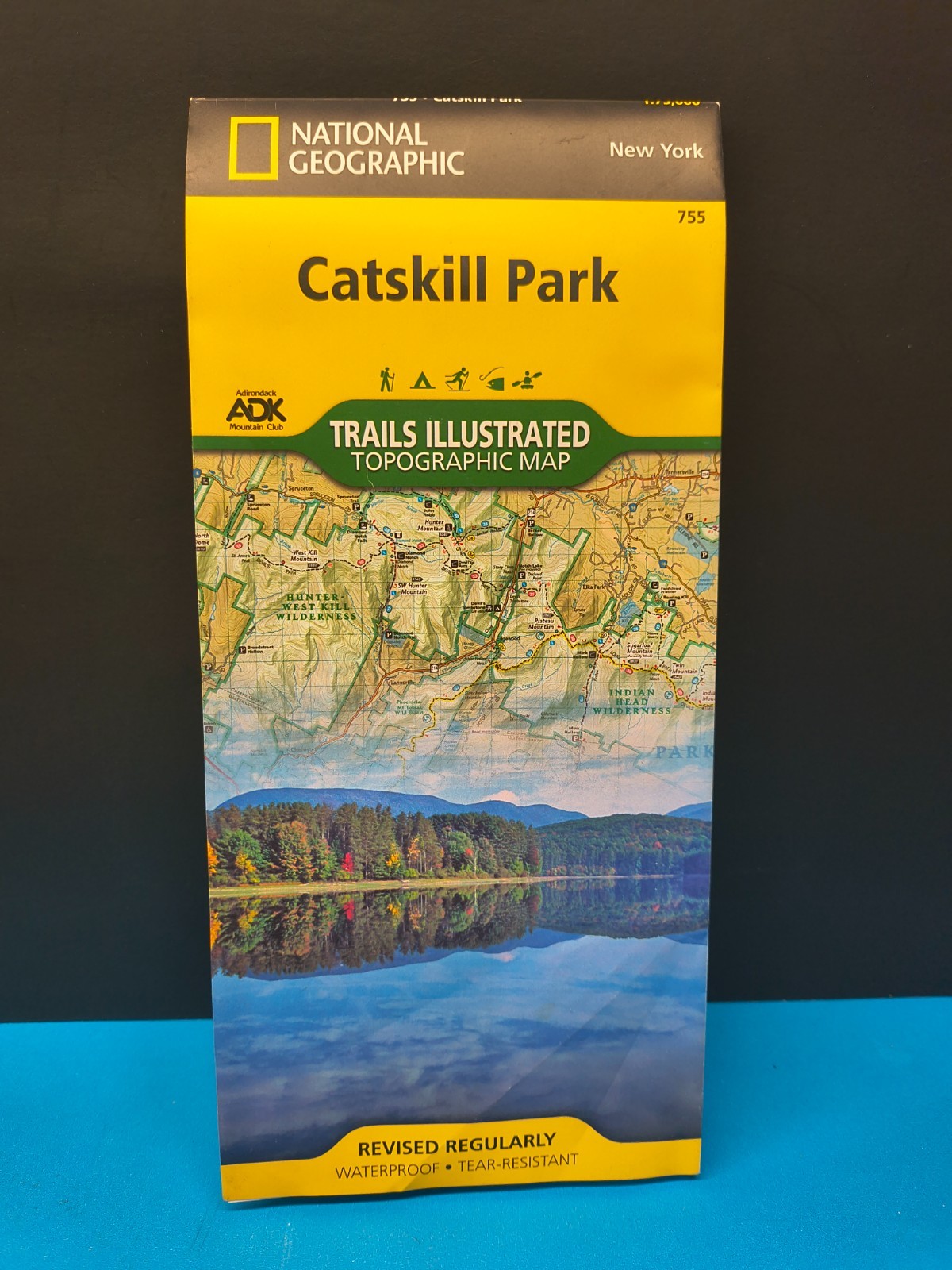

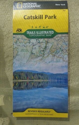
Catskill Park by National Geographic Maps - Trails Illustrated map 755 NY

US $9,99
Ca.EUR 8,51
Artikelzustand:
“Used in good or better condition.”
Gut
Buch, das gelesen wurde, sich aber in einem guten Zustand befindet. Der Einband weist nur sehr geringfügige Beschädigungen auf, wie z.B. kleinere Schrammen, er hat aber weder Löcher, noch ist er eingerissen. Bei gebundenen Büchern ist der Schutzumschlag möglicherweise nicht mehr vorhanden. Die Bindung weist geringfügige Gebrauchsspuren auf. Die Mehrzahl der Seiten ist unbeschädigt, das heißt, es gibt kaum Knitter oder Einrisse, es wurden nur in geringem Maße Bleistiftunterstreichungen im Text vorgenommen, es gibt keine Textmarkierungen und die Randbereiche sind nicht beschrieben. Alle Seiten sind vollständig vorhanden. Genauere Einzelheiten sowie eine Beschreibung eventueller Mängel entnehmen Sie bitte dem Angebot des Verkäufers.
- Sofort-KaufenCatskill Park by National Geographic Maps - Trails Illustrated map 755 NY
Oops! Looks like we're having trouble connecting to our server.
Refresh your browser window to try again.
Versand:
Kostenlos Economy Shipping.
Standort: Moncure, North Carolina, USA
Lieferung:
Lieferung zwischen Mo, 29. Sep und Do, 2. Okt bei heutigem Zahlungseingang
Rücknahme:
30 Tage Rückgabe. Kostenloser Rückversand.
Zahlungen:
Sicher einkaufen
- Gratis Rückversand im Inland
- Punkte für jeden Kauf und Verkauf
- Exklusive Plus-Deals
Der Verkäufer ist für dieses Angebot verantwortlich.
eBay-Artikelnr.:286838949688
Artikelmerkmale
- Artikelzustand
- Gut
- Hinweise des Verkäufers
- “Used in good or better condition.”
- Features
- Illustrated
- ISBN
- 9781566955881
Über dieses Produkt
Product Identifiers
Publisher
National Geographic Maps
ISBN-10
1566955882
ISBN-13
9781566955881
eBay Product ID (ePID)
113450648
Product Key Features
Edition
2023
Book Title
Catskill Park
Number of Pages
1 Pages
Language
English
Publication Year
2023
Topic
Maps & Road Atlases (See Also Reference / Atlases, Gazetteers & Maps), Special Interest / Hikes & Walks, United States / Northeast / Middle Atlantic (NJ, NY, Pa)
Illustrator
Yes
Genre
Travel
Book Series
National Geographic Trails Illustrated Map Ser.
Format
Sheet Map, Folded
Dimensions
Item Height
0.3 in
Item Weight
3.3 Oz
Item Length
9.2 in
Item Width
4.2 in
Additional Product Features
Intended Audience
Trade
Series Volume Number
755
Synopsis
- Waterproof - Tear-Resistant - Topographic Map National Geographic's Trails Illustrated map of Catskill Park is designed to meet the needs of outdoor enthusiasts by combining valuable information with unmatched detail of a park that consists of 700,000 acres of beautiful forests, mountains, rivers, and lakes. Created in partnership with the Adirondack Mountain Club (ADK) that provided trail information from its Forest Preserve Series of trail guides, this map will prove invaluable regardless of the season or the reason for your visit. Key areas of interest featured on this map include Ashokan, Pepacton, and Schoharie reservoirs; Belle Ayr Mountain; Slide Mountain Wilderness; Campbell Mountain; and Mongaup Pond. The print version of the map includes an inset of North/South Lake for additional detail. Whatever your chosen activity, the Catskill Park map can guide you off the beaten path and back again with a handy trail chart showing location, mileage, trail use, and difficulty levels for dozens of trails. Mileages between intersections are shown and the map base includes contour lines and elevations for summits, passes and many lakes. The Shawangunk Mountain Scenic Byway is noted for those wishing to take in the scenery by car. Public fishing easements, footbridges, swimming areas, snowmobile parking areas, boat launches, covered bridges, waterfalls, ski areas, and other points of interest are clearly marked. Every Trails Illustrated map is printed on "Backcountry Tough" waterproof, tear-resistant paper. A full UTM grid is printed on the map to aid with GPS navigation. Other features found on this map include: Ashokan Reservoir, Black Dome, Blackhead, Catskill Mountains, Cornell Mountain, Doubletop Mountain, Graham Mountain, Hunter Mountain, Kingston, Peekamoose Mountain, Pepacton Reservoir, Plateau Mountain, Rondout Reservoir, Slide Mountain, Table Mountain, Thomas Cole Mountain, Vly Mountain, Wawarsing, West Kill Mountain. Map Scale = 1:75,000 Sheet Size = 25.5" x 37.75" Folded Size = 4.25" x 9.25", National Geographic's Trails Illustrated Maps are the most detailed and up-to-date topographic recreation maps available for US National Parks, National Forests and other popular outdoor recreation areas. A necessity for exploring the outdoors, each map is printed on waterproof, tear-resistant material. They also contain key safety and contact information, GPS and compass coordinates, Leave No Trace ethical guidelines and hundreds of points-of-interest, including scenic viewpoints, campgrounds, boat launches, swimming areas, marine sanctuaries and wildlife refuges.
Artikelbeschreibung des Verkäufers
Rechtliche Informationen des Verkäufers
Info zu diesem Verkäufer

Bob's Junkyard
100% positive Bewertungen•2.120 Artikel verkauft
Angemeldet als gewerblicher Verkäufer
Verkäuferbewertungen (986)
- 4***s (355)- Bewertung vom Käufer.Letzte 6 MonateBestätigter KaufSeller shipped promptly and items were packaged nicely. Books were as described and a great value for the money. Would definitely buy from this seller again!American Girl 3 book lot. Felicity/Samantha (Nr. 286312275292)
- m***a (16)- Bewertung vom Käufer.Letzte 6 MonateBestätigter KaufBook arrived timely, excellently package so as to arrive undamaged. The book was in excellent condition as if purchased from the bookstore. Seller accurately described the condition of the book. I would definitely order from the seller again.
- s***4 (120)- Bewertung vom Käufer.Letzte 6 MonateBestätigter KaufArrived in great condition as described. Good communication between seller, who promptly replied to me with a request. Packaged very well and arrived in a timely manner. Thank you.
Produktbewertungen & Rezensionen
Relevanteste Rezensionen
- 31. Okt. 2017
Never Get Lost
Bestätigter Kauf: JaZustand: Neu
- 23. Jun. 2020
Excellent map
Bestätigter Kauf: JaZustand: NeuVerkauft von: studio20
- 25. Sep. 2018
useful
Bestätigter Kauf: JaZustand: NeuVerkauft von: bellaterramaps
- 01. Apr. 2020
Map
Bestätigter Kauf: JaZustand: NeuVerkauft von: ubargain
Noch mehr entdecken:
- National Geographic Zeitschriften,
- National Geographic Zeitschriften Nachrichten,
- Atlanten und Landkarten National Geographic,
- National Geographic Studium und Erwachsenenbildung,
- National Geographic Sachbuch Bücher,
- Monatliche National Geographic Zeitschriften Nachrichten,
- Deutsche Bücher Sachbuch National Geographic,
- Reisen-Sachbuch-National-Geographic Bücher,
- Englische National Geographic Atlanten und Landkarten,
- Englische National Geographic Sachbuch Bücher
Bob's Junkyard
100% positive Bewertungen•2.120 Artikel verkauft
Angemeldet als gewerblicher Verkäufer
Verkäuferbewertungen (986)
- 4***s (355)- Bewertung vom Käufer.Letzte 6 MonateBestätigter KaufSeller shipped promptly and items were packaged nicely. Books were as described and a great value for the money. Would definitely buy from this seller again!American Girl 3 book lot. Felicity/Samantha (Nr. 286312275292)
- m***a (16)- Bewertung vom Käufer.Letzte 6 MonateBestätigter KaufBook arrived timely, excellently package so as to arrive undamaged. The book was in excellent condition as if purchased from the bookstore. Seller accurately described the condition of the book. I would definitely order from the seller again.
- s***4 (120)- Bewertung vom Käufer.Letzte 6 MonateBestätigter KaufArrived in great condition as described. Good communication between seller, who promptly replied to me with a request. Packaged very well and arrived in a timely manner. Thank you.