Bild 1 von 4


Galerie
Bild 1 von 4


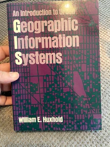
Spatial Information Systems Ser.: An Introduction to Urban Geographic...
South Saxon Books
(2846)
Gewerblich
US $4,99
Ca.EUR 4,33
oder Preisvorschlag
Artikelzustand:
- Sofort-KaufenSpatial Information Systems Ser.: An Introduction to Urban Geographic...
Oops! Looks like we're having trouble connecting to our server.
Refresh your browser window to try again.
Versand:
US $5,50 (ca. EUR 4,78) USPS Media MailTM.
Standort: Sussex, New Jersey, USA
Lieferung:
Lieferung zwischen Fr, 28. Nov und Mi, 3. Dez nach 94104 bei heutigem Zahlungseingang
Rücknahme:
30 Tage Rückgabe. Käufer zahlt Rückversand. Wenn Sie ein eBay-Versandetikett verwenden, werden die Kosten dafür von Ihrer Rückerstattung abgezogen.
Zahlungen:
Sicher einkaufen
- Gratis Rückversand im Inland
- Punkte für jeden Kauf und Verkauf
- Exklusive Plus-Deals
Info zum Artikel
Der Verkäufer ist für dieses Angebot verantwortlich.
eBay-Artikelnr.:145918595758
Artikelmerkmale
- Artikelzustand
- ISBN
- 9780195065350
Über dieses Produkt
Product Identifiers
Publisher
Oxford University Press, Incorporated
ISBN-10
0195065352
ISBN-13
9780195065350
eBay Product ID (ePID)
68097
Product Key Features
Number of Pages
376 Pages
Language
English
Publication Name
Introduction to Urban Geographic Information Systems
Subject
Cartography, Earth Sciences / Geography, Remote Sensing & Geographic Information Systems, Sociology / Urban
Publication Year
1991
Type
Textbook
Subject Area
Technology & Engineering, Social Science, Science
Series
Spatial Information Systems Ser.
Format
Trade Paperback
Dimensions
Item Height
0.7 in
Item Weight
20.1 Oz
Item Length
9.2 in
Item Width
6.5 in
Additional Product Features
Intended Audience
College Audience
LCCN
90-007095
Dewey Edition
20
TitleLeading
An
Reviews
"Good basic introduction to urban GIS plan to use in marketing and sales forecasting for retail locations."--James H. Underwood, University of Southwestern Louisiana, "Testimony to the successful implementation of GIS documented for a singlecity, the city of Milwaukee, Wisconsin....Superb....Although limited to onecity, its exercises and description of this system demonstrates realapplications and make a case for long term commitment to GIS for the improvementof local governments and public access to information of the cities we all shareas principal living spaces."--International Journal of Geographical InformationSystems, "An excellent book and the best I have found as a text for a college course. The author has obviously had many years experience in his field."--P. Boniface, California State Polytech University, "A good introduction to basic concepts and definitions of GIS....Provides a good set of exercises to test understanding of the concepts introduced."--Public Administration Review, "An excellent text for urban GIS. I especially like the Milwaukee examples and list of applications elsewhere. I use the exercises a great deal."--William Craig, University of Minnesota, "A good introduction to basic concepts and definitions of GIS....Providesa good set of exercises to test understanding of the conceptsintroduced."--Public Administration Review, "Huxhold will become a recommended text for students who are focusing onurban applications."--Dueker/URISA Journal, "This text is a very good introductory guide for surveyors. It covers all technical aspects of a GIS by municipalities."--Indrajith Wijayratne, Michigan Tech University, "An excellent text for urban GIS. I especially like the Milwaukeeexamples and list of applications elsewhere. I use the exercises a greatdeal."--William Craig, University of Minnesota, "Perhaps the most practical explanation of how it is actually done. Verygood"--David W. Gibson, University of Florida, "Huxhold will become a recommended text for students who are focusing on urban applications."--Dueker/URISA Journal, "Good basic introduction to urban GIS plan to use in marketing and salesforecasting for retail locations."--James H. Underwood, University ofSouthwestern Louisiana, "Very readable....Each chapter ends with a number of suggested exercisesthat reinforce that chapter's main points. Professors and professionals alikewill find these exercises very useful....Chapter 7 should be required readingfor any city agency hoping to implement a GIS. Huxhold clearly spells out thetechnical and political processes that a city will need to go through to makeGIS a reality."--Geo Info Systems, "Testimony to the successful implementation of GIS documented for a single city, the city of Milwaukee, Wisconsin....Superb....Although limited to one city, its exercises and description of this system demonstrates real applications and make a case for long term commitment to GIS for theimprovement of local governments and public access to information of the cities we all share as principal living spaces."--International Journal of Geographical Information Systems, "If a student of city planning, geography, or urban administration reads only one book related to urban geographic information systems, I would heartily recommend this one. It also deserves to be read by others interested in doing urban GIS."--Urisa Journal
Series Volume Number
No. 2
Illustrated
Yes
Dewey Decimal
910/.285
Table Of Content
Information in the organization; Geographic information systems defined; Applications of geographic information systems; Topological data structures; Geographic base files; Land records information; The model urban GIS project; Applications digest; Glossary; Index
Synopsis
A nuts-and-bolts introduction to geographic information systems (GIS), this book outlines the basic concepts and diverse uses of this technology in a local government environment. Emphasizing the value of integrating data from various sources, the book provides a set of tools for improving the way public services are delivered, resources are managed, and policy decisions are made. Rather than stressing the computer technology that is so rapidly changing in the GIS industry, this book concentrates on the concepts upon which this technology is based: information systems design, computer-aided mapping, topological data structures, geographic base files, and land records systems. It also provides the latest information on the U.S. Census Bureau's TIGER files and the Global Positioning Satellite System established by the U.S. Department of Defense. Special features include fourteen case studies, a chapter describing the enormous effort required to set up and manage a typical GIS project, and an appendix on who is using GIS technology and how it is being used. Whether they run the GIS or help run the government, readers of An Introduction to Urban Geographic Information Systems will learn efficient and effective methods for improving the impact that local government has on its citizens., A nuts-and-bolts introduction to geographic information systems (GIS), this book outlines the basic concepts and diverse uses of this technology in a local government environment. Emphasizing the value of integrating data from various sources, the book provides a set of tools for improving the way public services are delivered, resources are managed, and policy decisions are made. Rather than stressing the computer technology that is so rapidly changing in the GISindustry, this book concentrates on the concepts upon which this technology is based: information systems design, computer-aided mapping, topological data structures, geographic base files, and landrecords systems. It also provides the latest information on the U.S. Census Bureau's TIGER files and the Global Positioning Satellite System established by the U.S. Department of Defense. Special features include fourteen case studies, a chapter describing the enormous effort required to set up and manage a typical GIS project, and an appendix on who is using GIS technology and how it is being used. Whether they run the GIS or help run the government, readers of An Introduction to UrbanGeographic Information Systems will learn efficient and effective methods for improving the impact that local government has on its citizens.
LC Classification Number
G70.2.H88 1991
Artikelbeschreibung des Verkäufers
Rechtliche Informationen des Verkäufers
Info zu diesem Verkäufer
South Saxon Books
100% positive Bewertungen•9.711 Artikel verkauft
Angemeldet als gewerblicher Verkäufer
Verkäuferbewertungen (5.508)
- *****- Bewertung vom Käufer.Letzter MonatBestätigter KaufQuick shipping, extra protection in padded envelope. Book was as described and at great price, top notch seller.
- k***1 (384)- Bewertung vom Käufer.Letzte 6 MonateBestätigter KaufAs described, fast shipping, packaged securely. Recommend seller! A+++The Courtship of Gould's Manakin (Manacus vitellinus vitellinus) on Barro Colora (Nr. 143345537586)
- m***j (4798)- Bewertung vom Käufer.Letzte 6 MonateBestätigter KaufFantastic deal, great communications with vendor, secure and EFFECTIVE packaging, rapid shipping, flawless transaction!!!!Men-At-Arms Ser.: Prussian Line Infantry 1792-1815 by Bryan Fosten and Peter... (Nr. 145494458182)
Noch mehr entdecken:
- National Geographic Zeitschriften,
- National Geographic Zeitschriften Nachrichten,
- National Geographic Studium und Erwachsenenbildung,
- Atlanten und Landkarten National Geographic,
- National Geographic Sachbuch Bücher,
- Monatliche National Geographic Zeitschriften Nachrichten,
- Englische National Geographic Sachbuch Bücher,
- National Geographic Sachbuch Bücher Bücher,
- National Geographic Fachbücher, Lernen und Nachschlagen,
- Deutsche Bücher Sachbuch National Geographic