Bild 1 von 1

Galerie
Bild 1 von 1

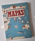
Maps
US $11,17
Ca.EUR 9,64
oder Preisvorschlag
Artikelzustand:
- Sofort-KaufenMaps
Oops! Looks like we're having trouble connecting to our server.
Refresh your browser window to try again.
Versand:
Kostenlos USPS Media MailTM.
Standort: San Diego, California, USA
Lieferung:
Lieferung zwischen Sa, 15. Nov und Mi, 19. Nov nach 94104 bei heutigem Zahlungseingang
Rücknahme:
30 Tage Rückgabe. Käufer zahlt Rückversand. Wenn Sie ein eBay-Versandetikett verwenden, werden die Kosten dafür von Ihrer Rückerstattung abgezogen.
Zahlungen:
Sicher einkaufen
- Gratis Rückversand im Inland
- Punkte für jeden Kauf und Verkauf
- Exklusive Plus-Deals
Der Verkäufer ist für dieses Angebot verantwortlich.
eBay-Artikelnr.:326840690571
Artikelmerkmale
- Artikelzustand
- Release Year
- 2013
- ISBN
- 9780763668969
Über dieses Produkt
Product Identifiers
Publisher
Candlewick Press
ISBN-10
0763668966
ISBN-13
9780763668969
eBay Product ID (ePID)
160049114
Product Key Features
Book Title
Maps
Number of Pages
112 Pages
Language
English
Topic
People & Places / General, Reference / Atlases, Social Science / Customs, Traditions, Anthropology, Science & Nature / Earth Sciences / Geography
Publication Year
2013
Genre
Juvenile Nonfiction
Format
Picture Book
Dimensions
Item Height
0.7 in
Item Weight
43.5 Oz
Item Length
14.8 in
Item Width
11 in
Additional Product Features
Intended Audience
Juvenile Audience
Dewey Edition
23
Reviews
[A] sumptuous illustrated children's atlas that combines chic, muted colors with witty and informative drawings on heavy matte paper that whispers under the fingers. ... The sort of book you can't help touching, "Maps" is as likely to engross adults as it is 7- to 10-year-olds. ... [I]t gives aesthetic pleasure all the way from the table of contents to the flags of the world at book's end. -The Wall Street Journal This handsome and fun-to-browse volume will inspire armchair travelers. ... The artwork's muted earth tones, decorative borders, and fine-lined drawings are reminiscent of an antique rendering, while the numerous small cartoon illustrations add a light, contemporary touch. ... [W]insome renderings. -School Library Journal [A] nonfiction visual feast... [G]loriously portrays the world's profusion of creatures, mountains and man-made structures in chic, subdued shades of beige, mauve and eau de Nil. -The Wall Street Journal, [A] sumptuous illustrated children's atlas that combines chic, muted colors with witty and informative drawings on heavy matte paper that whispers under the fingers. ... The sort of book you can't help touching, "Maps" is as likely to engross adults as it is 7- to 10-year-olds. ... [I]t gives aesthetic pleasure all the way from the table of contents to the flags of the world at book's end. -The Wall Street Journal This handsome and fun-to-browse volume will inspire armchair travelers. ... The artwork's muted earth tones, decorative borders, and fine-lined drawings are reminiscent of an antique rendering, while the numerous small cartoon illustrations add a light, contemporary touch. ... [W]insome renderings. -School Library Journal [A] nonfiction visual feast... [G]loriously portrays the world's profusion of creatures, mountains and man-made structures in chic, subdued shades of beige, mauve and eau de Nil. -The Wall Street Journal A visual extravaganza with fascinating trivia in pages as spacious and luxurious as a classic road atlas. It's an invitation to travel around the world one page at a time. ... "Maps" is a treat, with its richness of details catering to young readers in this electronic age who thrive on all kinds of visual stimuli. This book will also appeal to other members of the family. All will scour for details and trivia as obscure, fun and varied as where one might sandboard or see a yak. -Shelf Awareness for Readers Not exactly your library's world atlas. These maps, illustrated in distinctive style by the authors, denote the culture and history of a place rather than its exact coordinates. -Entertainment Weekly [F]eatures playful line drawings of national and geographical attributes, including famous native folk (Freud, Kandinsky, Count Dracula). ... [A]n entertaining and informative choice for budding geographers or Eurail travelers-to-be. -The New York Times Book Review, [A] sumptuous illustrated children's atlas that combines chic, muted colors with witty and informative drawings on heavy matte paper that whispers under the fingers. ... The sort of book you can't help touching, "Maps" is as likely to engross adults as it is 7- to 10-year-olds. ... [I]t gives aesthetic pleasure all the way from the table of contents to the flags of the world at book's end. -The Wall Street Journal This handsome and fun-to-browse volume will inspire armchair travelers. ... The artwork's muted earth tones, decorative borders, and fine-lined drawings are reminiscent of an antique rendering, while the numerous small cartoon illustrations add a light, contemporary touch. ... [W]insome renderings. -School Library Journal [A] nonfiction visual feast... [G]loriously portrays the world's profusion of creatures, mountains and man-made structures in chic, subdued shades of beige, mauve and eau de Nil. -The Wall Street Journal A visual extravaganza with fascinating trivia in pages as spacious and luxurious as a classic road atlas. It's an invitation to travel around the world one page at a time. ... "Maps" is a treat, with its richness of details catering to young readers in this electronic age who thrive on all kinds of visual stimuli. This book will also appeal to other members of the family. All will scour for details and trivia as obscure, fun and varied as where one might sandboard or see a yak. -Shelf Awareness for Readers, [A] sumptuous illustrated children's atlas that combines chic, muted colors with witty and informative drawings on heavy matte paper that whispers under the fingers. ... The sort of book you can't help touching, "Maps" is as likely to engross adults as it is 7- to 10-year-olds. ... [I]t gives aesthetic pleasure all the way from the table of contents to the flags of the world at book's end. -The Wall Street Journal This handsome and fun-to-browse volume will inspire armchair travelers. ... The artwork's muted earth tones, decorative borders, and fine-lined drawings are reminiscent of an antique rendering, while the numerous small cartoon illustrations add a light, contemporary touch. ... [W]insome renderings. -School Library Journal, [F]eatures playful line drawings of national and geographical attributes, including famous native folk (Freud, Kandinsky, Count Dracula). ... [A]n entertaining and informative choice for budding geographers or Eurail travelers-to-be. --The New York Times Book Review [A] delight to explore, as the Mizielinskis fill their maps with tiny labeled images of local wildlife, cuisine, activities, and notable citizens... Compelling. --Publishers Weekly Handsomely detailed illustrations include major industries, regional insects, birds, fish, and other animals, plants, crops and prepared food, and famous people. ... This book supports and encourages geographic literacy. --Library Media Connection (highly recommended) [R]ewarding fare ... for both young cartografiends and armchair travelers. --Kirkus Reviews This handsome and fun-to-browse volume will inspire armchair travelers. ... The artwork's muted earth tones, decorative borders, and fine-lined drawings are reminiscent of an antique rendering, while the numerous small cartoon illustrations add a light, contemporary touch. ... [W]insome renderings. --School Library Journal At once a celebration of diversity and an investigation of the natural and cultural offerings that make each country unique, this expansive and impressive book of maps ... is richly detailed with dozens of extraordinary drawings... Hours of fascinating perusal await. --Foreword Reviews There is no dearth of atlases for children, but Aleksandra and Daniel Mizielinski's "Maps" is a standout. ... [The authors'] enthusiasm and love for facts kids might want to know shine forth in charming little illustrations. --Newsday [A] sumptuous illustrated children's atlas that combines chic, muted colors with witty and informative drawings on heavy matte paper that whispers under the fingers. ... The sort of book you can't help touching, "Maps" is as likely to engross adults as it is 7- to 10-year-olds. ... [I]t gives aesthetic pleasure all the way from the table of contents to the flags of the world at book's end. --The Wall Street Journal [A] nonfiction visual feast... [G]loriously portrays the world's profusion of creatures, mountains and man-made structures in chic, subdued shades of beige, mauve and eau de Nil. --The Wall Street Journal A visual extravaganza with fascinating trivia in pages as spacious and luxurious as a classic road atlas. It's an invitation to travel around the world one page at a time. ... "Maps" is a treat, with its richness of details catering to young readers in this electronic age who thrive on all kinds of visual stimuli. This book will also appeal to other members of the family. All will scour for details and trivia as obscure, fun and varied as where one might sandboard or see a yak. --Shelf Awareness for Readers Along with geographical features and pictures, you'll find amusing depictions of indigenous animals, native dress and characteristic architecture... Between the buildings, food and history, the maps will awaken a wanderlust for unfamiliar and exotic locale. --Metro Philadelphia Not exactly your library's world atlas. These maps, illustrated in distinctive style by the authors, denote the culture and history of a place rather than its exact coordinates. --Entertainment Weekly, [A] sumptuous illustrated children's atlas that combines chic, muted colors with witty and informative drawings on heavy matte paper that whispers under the fingers. ... The sort of book you can't help touching, "Maps" is as likely to engross adults as it is 7- to 10-year-olds. ... [I]t gives aesthetic pleasure all the way from the table of contents to the flags of the world at book's end. -The Wall Street Journal
Grade From
Fifth Grade
Grade To
Twelfth Grade
Dewey Decimal
912
Synopsis
Travel the world without leaving your living room. This book of maps is a visual feast for readers of all ages, with lavishly drawn illustrations from the incomparable Mizielinskis. It features not only borders, cities, rivers, and peaks, but also places of historical and cultural interest, eminent personalities, iconic animals and plants, cultural events, and many more fascinating facts associated with every region of our planet.
Artikelbeschreibung des Verkäufers
Rechtliche Informationen des Verkäufers
Info zu diesem Verkäufer
Benjamins bookshelf
99,6% positive Bewertungen•23.510 Artikel verkauft
Angemeldet als gewerblicher Verkäufer
Verkäuferbewertungen (7.910)
- l***p (21)- Bewertung vom Käufer.Letzter MonatBestätigter KaufI received quality items in excellent condition as pictured. The packaging was great and kept my shipment well protected. I received my purchase fast and had no communication problems with the seller who was very helpful. 100% would purchase from this seller again.
- e***n (2265)- Bewertung vom Käufer.Letzte 6 MonateBestätigter KaufExcellent seller📡, great communication📞, fast delivery 🚚 , extra care in packing for shipment 📦, great price 💰, Came as shown in photo📸, I would do repeat buys in 1 sec with this seller. AAAA ++++. 5 st🌟rs. <(•🪖•)>Great Battles for Boys the Korean War (Nr. 326650524269)
- i***e (5240)- Bewertung vom Käufer.Letzte 6 MonateBestätigter KaufThe book arrived promptly and in good shape, as described, and packaged in a sturdy little cardboard box, not a flimsy mailing bag. (When I receive a book packaged only in a plastic bag, that's an instant negative, as far as I'm concerned.) So, to sum up: I'm pleased.Basin and Range - John McPhee (Nr. 326579640173)
Produktbewertungen & Rezensionen
Relevanteste Rezensionen
- 14. Okt. 2020
Great Resource for any classroom or homeschool room!
Bestätigter Kauf: JaZustand: GebrauchtVerkauft von: 6455patti
- 28. Feb. 2024
Great purchase
Bestätigter Kauf: JaZustand: GebrauchtVerkauft von: goodwill_industries_of_south_florida
- 27. Mai. 2024
Nice book at a nice price.
Bestätigter Kauf: JaZustand: GebrauchtVerkauft von: second.sale
- 13. Mai. 2022
Really nice illustrations
Bestätigter Kauf: JaZustand: GebrauchtVerkauft von: zbkinternational
